The trial is part of DPRID’s Working for Whales project which is engaging with businesses and industries across the State that operate in whale migratory areas to develop new ways to collect data and information on whale movements and behaviours.
This data will be used by DPIRD researchers to refine management measures to protect migrating humpback whales and mitigate potential entanglements, while also minimising impacts on fishers and other water users.
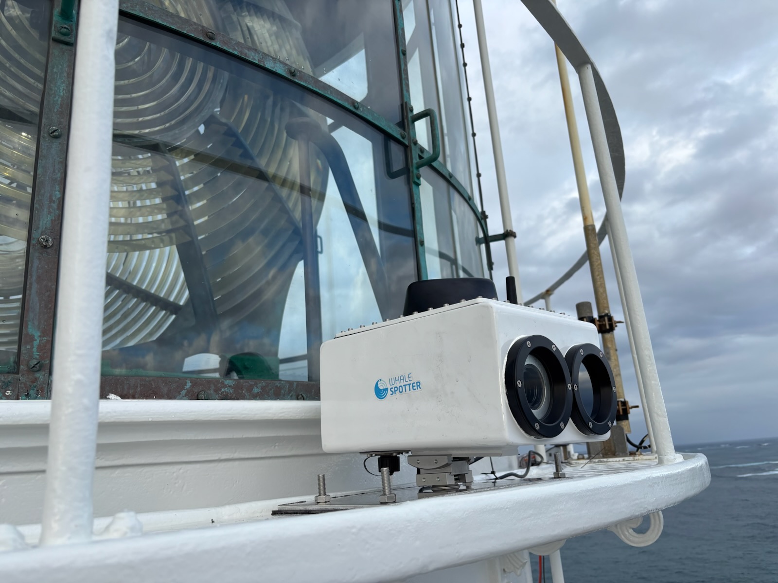
DPIRD Principal Research Scientist Jason How said the thermal imaging camera was currently located on the Leeuwin lighthouse, which due to its height above sea level and proximity to migrating whales, provided a great vantage point to detect whales.
“DPIRD worked with Capes Foundation, part of the Margret River Busselton Tourism Association, to install the camera on the lighthouse which will stay in place until August to capture the northern whale migration season,” he said.
“The camera system uses thermal imaging to detect whale blows, which have distinct thermal signatures, coupled with AI processing of the data to record the sighting.
“The data will be analysed to produce a daily count of whales detected. This information will then be used to determine the peak migration period for humpback whales heading north and south to help inform fisheries management arrangements to mitigate whale entanglements.”
Dr How said DPIRD was also exploring working other businesses including charter flight operators and whale watching companies to gather whale migration data.
“Much like ferries, charter flights often fly the same routes enabling them to potentially conduct 'surveys', which record where whales were sighted, but also where they weren’t seen which can be equally as valuable,” he said.
Dr How said reporting sighting of whales via the revamped Marine Fauna Sightings app was another a great way for the community to contribute to important fisheries research by providing more specific and timely information on whale movements along our coast.
“If you sight a whale, it only takes a couple of minutes to use the app and make a report,” he said.
“The app automatically adds the GPS location, date and time from the phone or device to pinpoint the location of the sighting and then you can take a photo and upload as part of the report if you like.”
The Marine Fauna Sightings app was developed with the support of the Fisheries Research and Development Corporation and Western Rock Lobster, led by the Department of Primary Industries and Regional Development in partnership with Australian Antarctic Division and the Department of Biodiversity Conservation and Attractions.
The app can be downloaded from the Apple or Google Play stores or by visiting the DPIRD website