Groundbreaking technology developed by a Department of Primary Industries and Regional Development (DPIRD) research scientist has captured the attention of NASA and is now making its way into outer space.
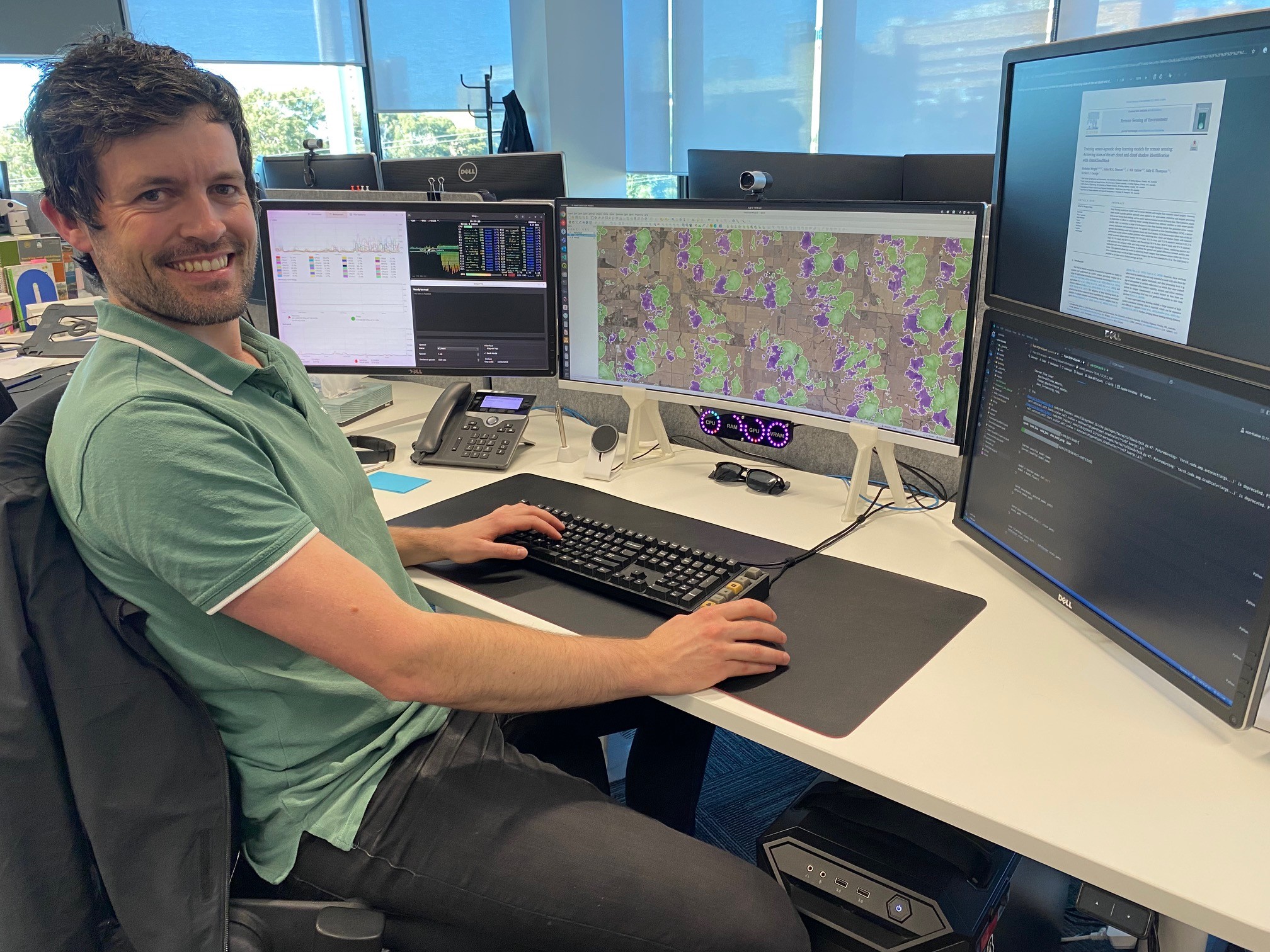
A cloud identification software package developed by research scientist Nick Wright to enable improved environmental monitoring, has been downloaded more than 135,000 times including by NASA and other international space organisations and universities.
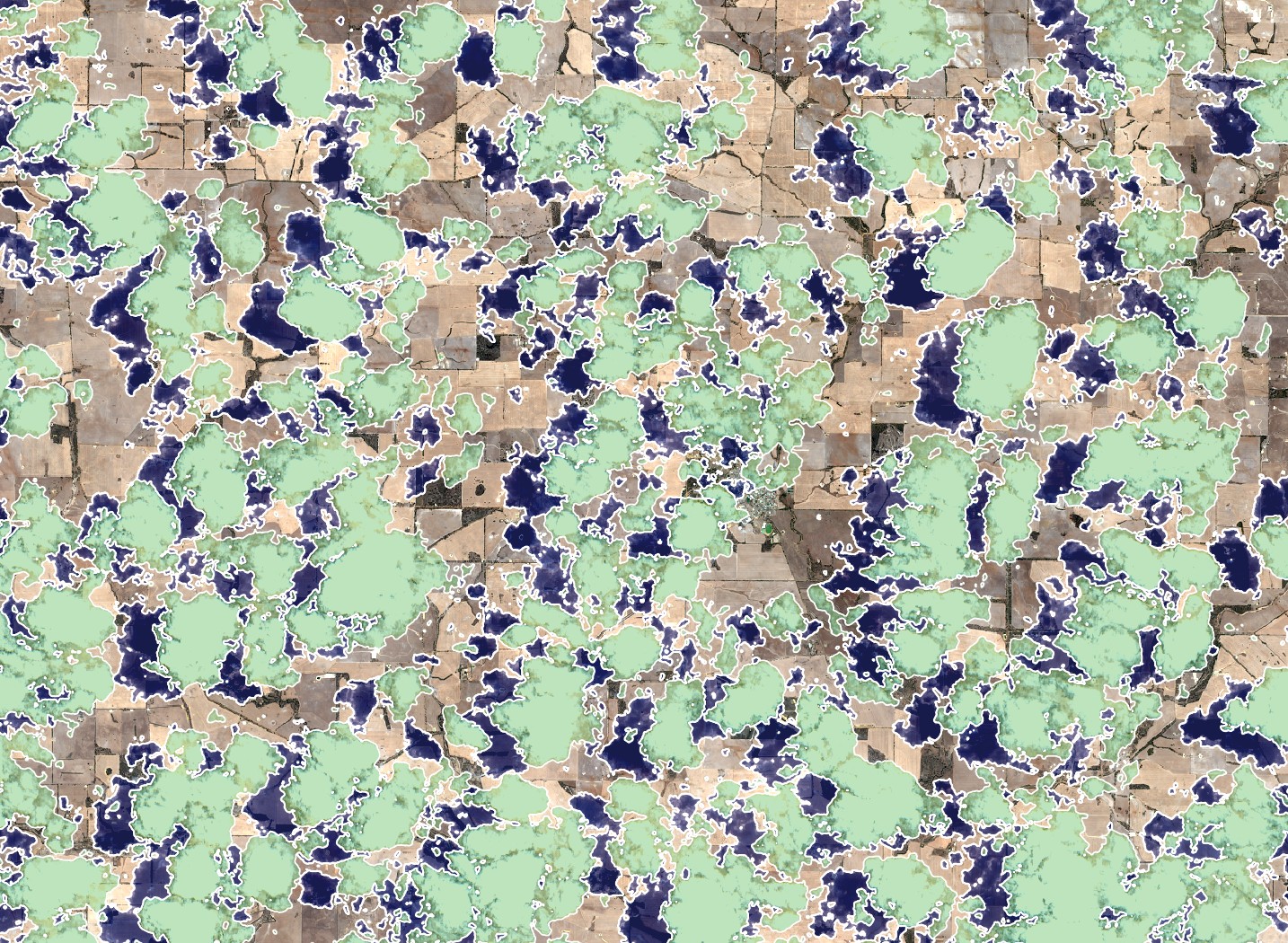
The open-source OmniCloudMask package uses deep learning technology to identify cloud and cloud shadow contaminated pixels in satellite imagery with high accuracy and efficiency.
The technology was developed as part of Mr Wright’s PhD studies with The University of Western Australia, supported by DPIRD, researching the use of satellite imaging to monitor water in farm dams.
Working in DPIRD’s water science team, Mr Wright’s research will help the team make more informed decisions and enable them to alert farmers when there is a water deficiency or declining water levels on their farms.
“As a remote sensing analyst, cloud contamination in satellite imagery causes great frustration. Without adequate identification these features can negatively impact downstream products and assessments,” Mr Wright said.
“We needed to develop new generalisable methods to identify clouds and cloud shadows more accurately and efficiently to enable large scale assessments, such as monitoring farm dams in WA.”
Mr Wright said unlike other approaches, OmniCloudMask could be applied to a wide range of imagery sources from different satellites while maintaining state-of-the-art accuracy.
“OmniCloudMask offers remote sensing practitioners better analysis tools so they can get an improved understanding of the Earth’s surface, providing insights for a range of applications including environmental and agricultural applications,” he said.
“The accuracy and robustness of OmniCloudMask demonstrates its potential to significantly improve the processing of optical imagery, making it a valuable tool for the remote sensing community.
“It improves the reliability of automated analyses and reduces the manual effort needed to filter out cloud-contaminated data.”
Mr Wright said the decision was made to make the software open-source and freely available as he wanted to foster adoption and contribute back to the scientific and open-source communities.
Along with NASA, Mr Wright said he was aware a company is using OmniCloudMask to aid satellite-based methane emissions detections, and a Canadian space organisation in collaboration with universities is considering uploading the program directly to a satellite to assist with bushfire monitoring directly from space.