


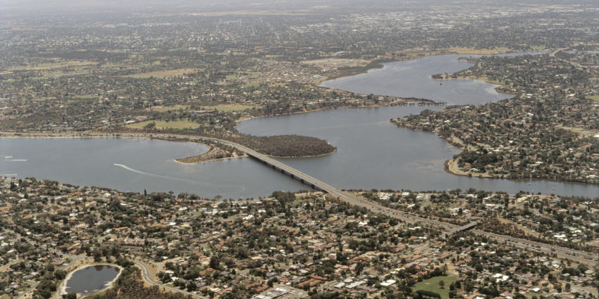
Mount Henry Bridge set within the Canning River connecting the Kwinana Freeway to the southern corridor of Perth.
Mount Henry Bridge is a major road bridge crossing the Canning River and an important example of late 20th century engineering in Western Australia.
Completed in 1982, the bridge was the last major structure designed and project-managed in-house by engineers of the Main Roads Department.
At 660 metres in length and 28.8 metres in width, it was the longest road bridge in the state at the time of construction.
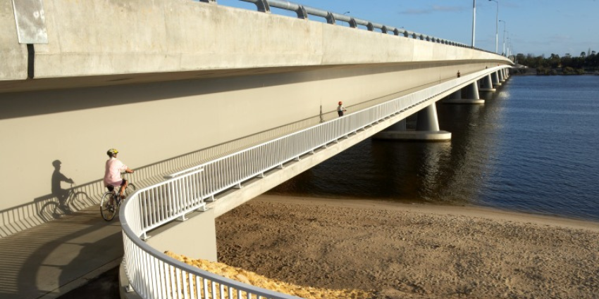
Mount Henry Bridge, showing shared pedestrian and cycle footway, cantilevered under the road bridge.
Mount Henry Bridge was entered in the State Register of Heritage Places in May 2026.
Acknowledgement of Country
Show moreThe Heritage Council acknowledges the Whadjuk Noongar people as the Traditional Custodians of the land on which this place is located, their enduring and continuing connection to the land, and its great significance for Aboriginal people. We pay our respects to the Ancestors and Elders, both past and present, and acknowledge those who continue to share knowledge and journey toward reconciliation. Information on the Whadjuk Aboriginal Corporation can be found at: https://whadjuknoongar.org.au/.
History
Show moreNoongar connection
The Canning River, known as Djarlgarra Beeliar, has long been a place of cultural, social and economic significance for Whadjuk Noongar people. It provided a source of food, water and resources and has been a focus of human activity for thousands of years.
Mount Henry Peninsula is associated with two Whadjuk groups: the Beeloo and the Beeliar. The river forms a boundary between these groups and functioned as a key movement corridor between the coastal plain and inland areas.
At the time of colonial settlement, several family groups held connection to this area, including those of Munday in the Beeloo District and Midgegooroo and his son Yagan in the Beeliar district.
Metropolitan planning and development
Planning for a north-south freeway system to bypass the Perth central business district was undertaken in 1955 by Gordon Stephenson and John Alastair Hepburn. The plan was adopted by State Parliament in 1963.
Increasing population growth and industrial activity in the Kwinana area during the 1970s placed pressure on existing river crossings, leading to the need for an additional crossing and extension of the Kwinana Freeway.
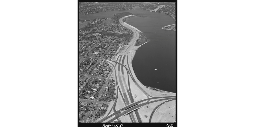
Aerial of freeway construction. Looking south to Salter Point. Canning Highway crosses in the foreground; at the centre Manning Road enters the Freeway. The Mount Henry Bridge has not been built yet.
Construction of the Mount Henry Bridge formed part of the second stage of the freeway extension to South Street. Works commenced in June 1979 and were completed in April 1982.
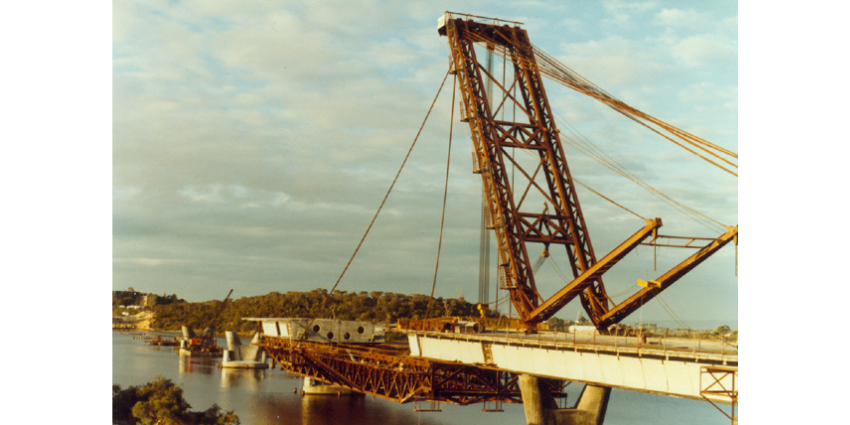
Mount Henry Bridge sectional extension
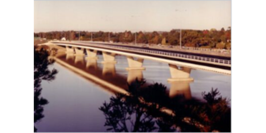
Mount Henry Bridge 1982
Design and construction
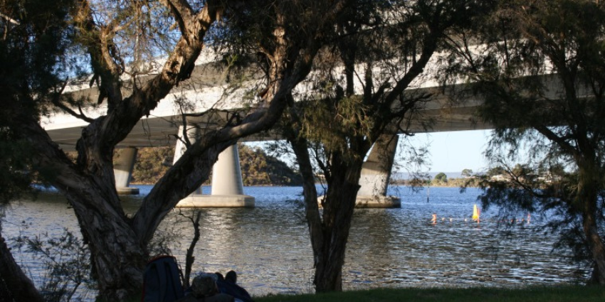
Mount Henry Peninsula Conservation Area
The bridge was designed by John Gilbert Marsh and constructed by J O Clough & Son using a balanced cantilever method.
The structure comprises nine spans of post-tensioned concrete with separate traffic decks. Cantilevered pedestrian and cycle paths are located beneath the carriageways, improving safety and functionality.
Its alignment and design respond to the river setting, enabling retention of a wide foreshore corridor on Mount Henry Peninsula and preserving stands of Nuytsia floribunda (Western Australian Christmas Tree) and mature paperbark trees.
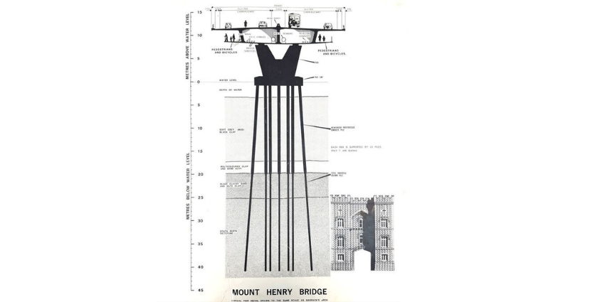
Engineering sketch of Mount Henry Bridge 1 (1982)
Aesthetic and environmental qualities
Despite its scale, the bridge is noted for its simple and elegant form. Strong horizontal lines, low profile railings and restrained use of materials contribute to a visually cohesive structure.
The design minimises visual impact while allowing the bridge to sit prominently yet sympathetically within the Canning River landscape. The Mount Henry Peninsula remains an important ecological corridor supporting fauna movement along the river foreshore.
State Register of Heritage Places and Themes
Show morePlace 4794. Mount Henry Bridge Register Entry
Themes relevant to this place, as identified in the Heritage Council’s Thematic History of Western Australia, include:
- Infrastructure – Transport
- Communications Infrastructure
- Development of Settlements and Services
Image gallery
Show more|
Mount Henry Bridge |
|
Mount Henry Bridge, showing shared pedestrian and cycle footway, cantilevered under the road bridge. |
|
Aerial of freeway construction. Looking south to Salter Point. Canning Highway crosses in the foreground; at the centre Manning Road enters the Freeway. Mount Henry Bridge has not been built yet. Source SLWA 325283PD |
|
Mount Henry Bridge, showing bridge construction on V-shaped original piers. |
|
Mount Henry Bridge. Accessed April 2026 Mount Henry Bridge - Clough |
|
Mount Henry Peninsula Conservation Area. Source – SLWA BA1798_080 |
|
Engineering sketch of Mount Henry Bridge 1 (1982) courtesy of Main Roads WA, showing depth of piles driven into the riverbed, and using Barracks Arch as scale. Reference: Edmonds. The Vital Link, 1997, p.288 |
