In 2023, we published five technical reports for Fitzroy water planning. See below for a summary of each of these technical documents, key downloadable maps and links to the full documents.
For current water planning for the area, see our Fitzroy-Derby water planning page.
Environmental and heritage values and the importance of water in the Fitzroy
The Environmental and heritage values and the importance of water in the Fitzroy report describes the environmental and heritage values that are listed under water, environment and heritage legislation, policy and guidance, and those that are dependent on water (surface and/or ground) in the planning area and King Sound.
It considers all available information, including newly published data, to describe the current understanding of how water-dependent ecosystems (habitats) and important species are supported by surface and/or groundwater in the Fitzroy planning area.
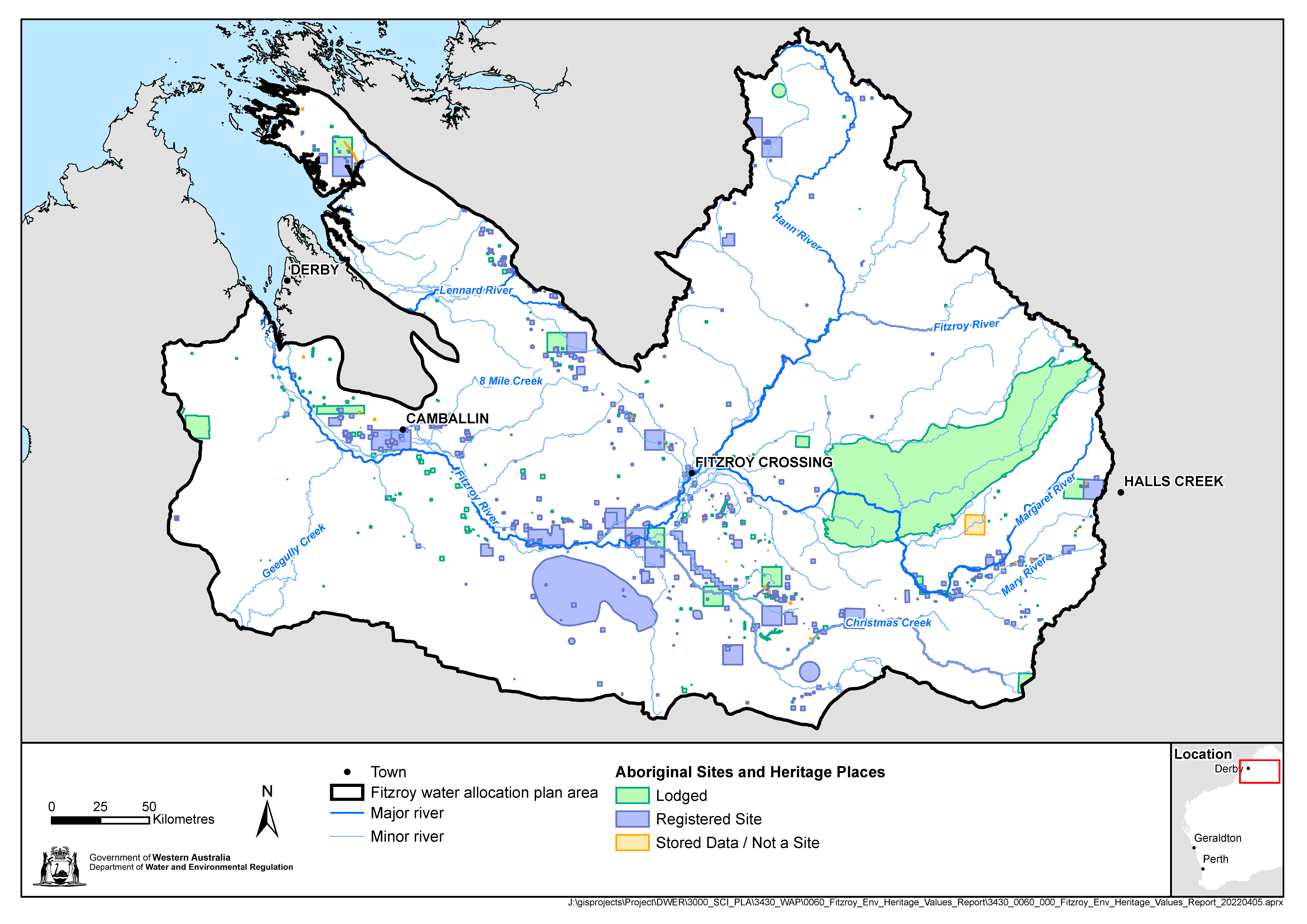
This report provides information on Aboriginal cultural heritage in the plan area where it is listed for protection under existing legislation. It does not provide information on Aboriginal cultural values. There is a growing body of work on cultural science, knowledge and values across the Fitzroy planning area, including recent work centred on the Fitzroy River. This is the knowledge of Traditional Owners and the department is not publishing this material in this report. The report does provide a brief description of some of the water-dependent plants and animal species that are specific importance to the people of the Fitzroy River.
Download the report and maps below.
Ecological water requirements of water-dependent ecosystems in the Fitzroy planning area
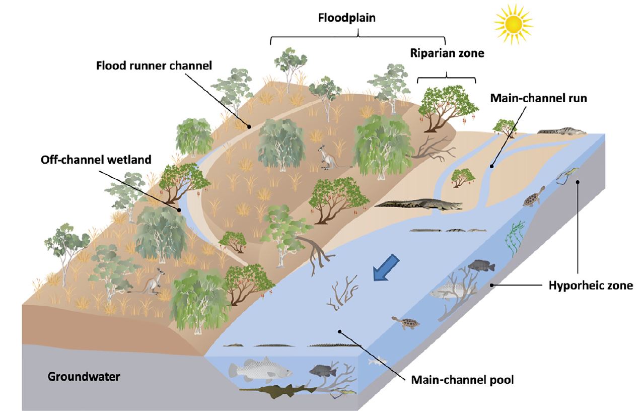
The Ecological water requirements of water-dependent ecosystems in the Fitzroy planning area report defines hydro-ecological outcomes by considering the components of the water regime (surface and groundwater) important to water-dependent habitats and the species they support. Then, using the new science from the Fitzroy and other relevant information, it describes the surface and/or groundwater conditions (e.g. pool depth, flow volume) required to meet the hydro-ecological outcomes. These are the ecological water requirements.
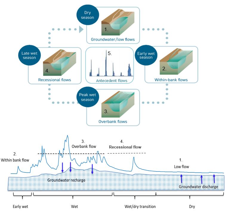
There are 20 hydro-ecological outcomes spread across the four main parts of the water regime previously described by UWA (Douglas et al. 2019):
- within bank flows during the wet season
- overbank flows during the wet season
- recessional flows at the end of wet season
- low flows/groundwater inputs during the dry season and dry years.
For 11 of these outcomes, we have evidence to describe an ecological water requirement (EWR). Some of these EWR apply to a specific location only. Others use evidence from targeted investigation that can be applied to habitats elsewhere in the Fitzroy planning area. For the remaining hydro-ecological outcomes, there is insufficient evidence to define an ecological water requirement. Available information is presented for these with work recommended to develop EWR at a local scale.
Download the report below.
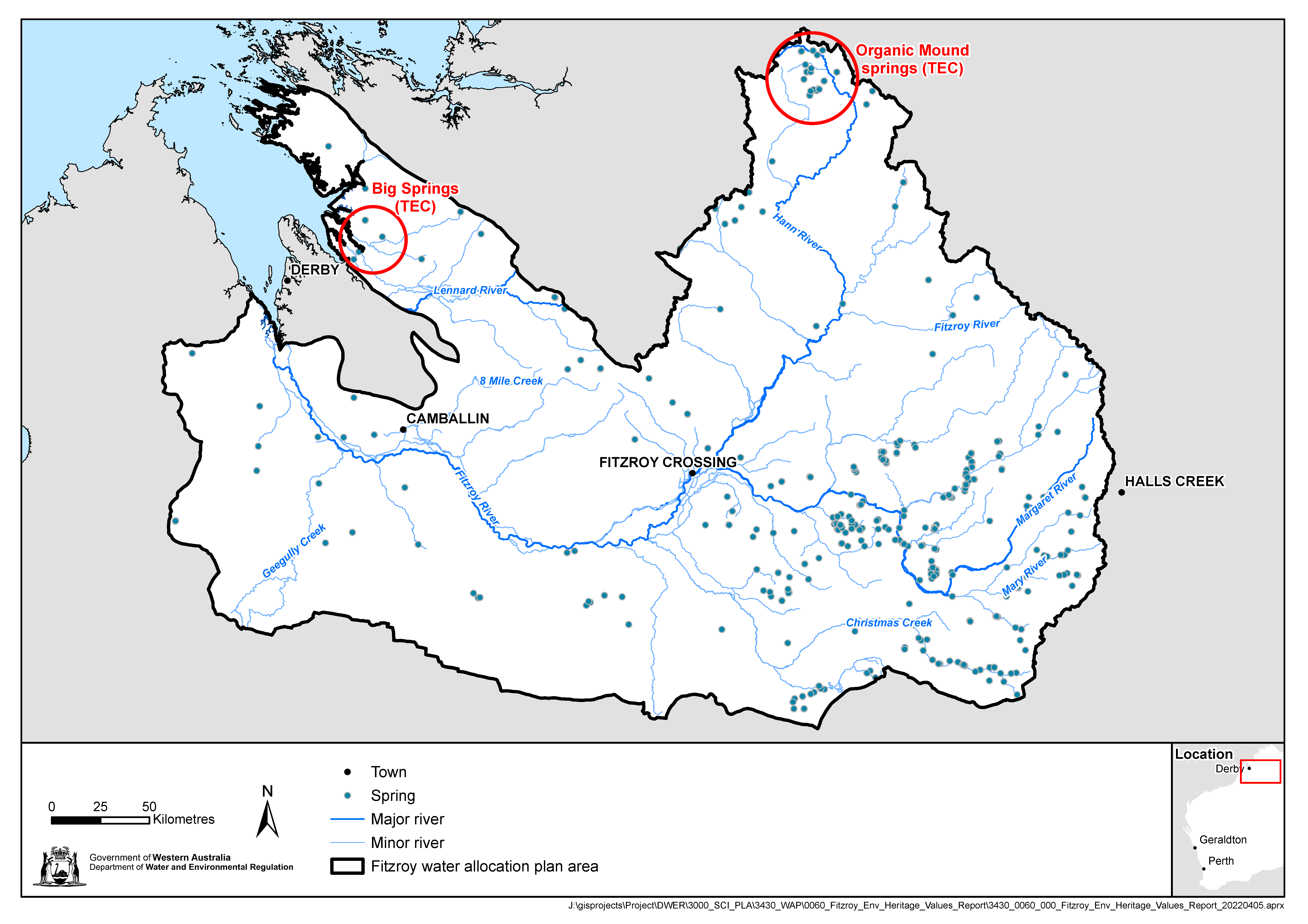
Fitzroy aquatic groundwater-dependent ecosystem dataset and report
Understanding the relationship between groundwater and water-dependent ecosystems assists the department to consider the impact of water abstraction when developing a water allocation plan, and when assessing a water licence application.
The Mapping aquatic groundwater-dependent ecosystems in the Fitzroy water planning area explanatory report is a supporting document to the Aquatic groundwater-dependent ecosystems in the Fitzroy planning area spatial dataset.
The dataset shows the location and spatial extent of known aquatic ecosystems and their reliance on the surface expression of groundwater. The explanatory report describes the process used to produce the dataset. The dataset will become available on data.wa.gov.au, the State Government’s Share Location Information Platform (SLIP). If you would like access to the dataset please email spatial.data@dwer.wa.gov.au and we will share the dataset with you.
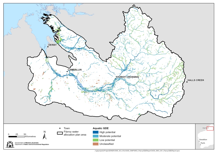
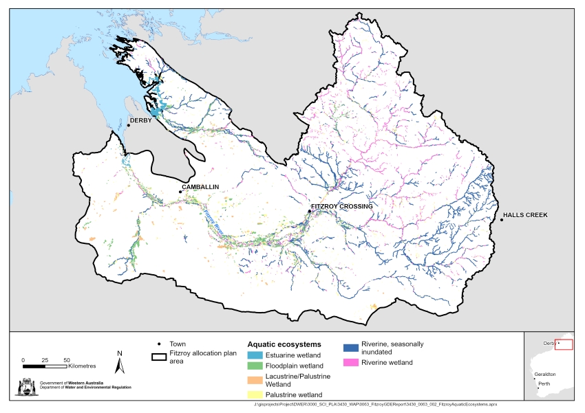
Download the report and maps below.
Fitzroy Valley groundwater investigations 2015–2018
Groundwater use in the Fitzroy Valley is historically low and, until recently, information about the region’s resources were at a broad, regional scale. There is increasing interest in developing the groundwater resources of the system’s principal regional aquifers to expand economic opportunities.
The Fitzroy Valley groundwater investigations 2015–2018 report presents targeted geological and hydrogeological information, synthesised to help improve the understanding of potential impacts of future groundwater use on sites of cultural and ecological significance, and to help formulate new groundwater management strategies, including developing the Fitzroy water allocation plan.
The groundwater investigation completed a series of drilling programs, installed purpose-built monitoring bores, and collected targeted airborne electromagnetic (AEM) data. In addition, several groundwater and surface water sampling campaigns were conducted. From newly installed monitoring bores we collected time-series groundwater-level data for multiple aquifers in the Fitzroy Valley for the first time.
The findings include new and revised information on groundwater recharge, inter-aquifer connectivity and groundwater-surface water interactions with the Fitzroy and Margaret rivers. We also evaluate groundwater prospectivity and highlight important groundwater management considerations for both the regional and alluvial aquifers.
The groundwater investigations report has been reviewed by an independent hydrogeological consultant and CSIRO.
Visit our website for more information on Fitzroy groundwater investigations.
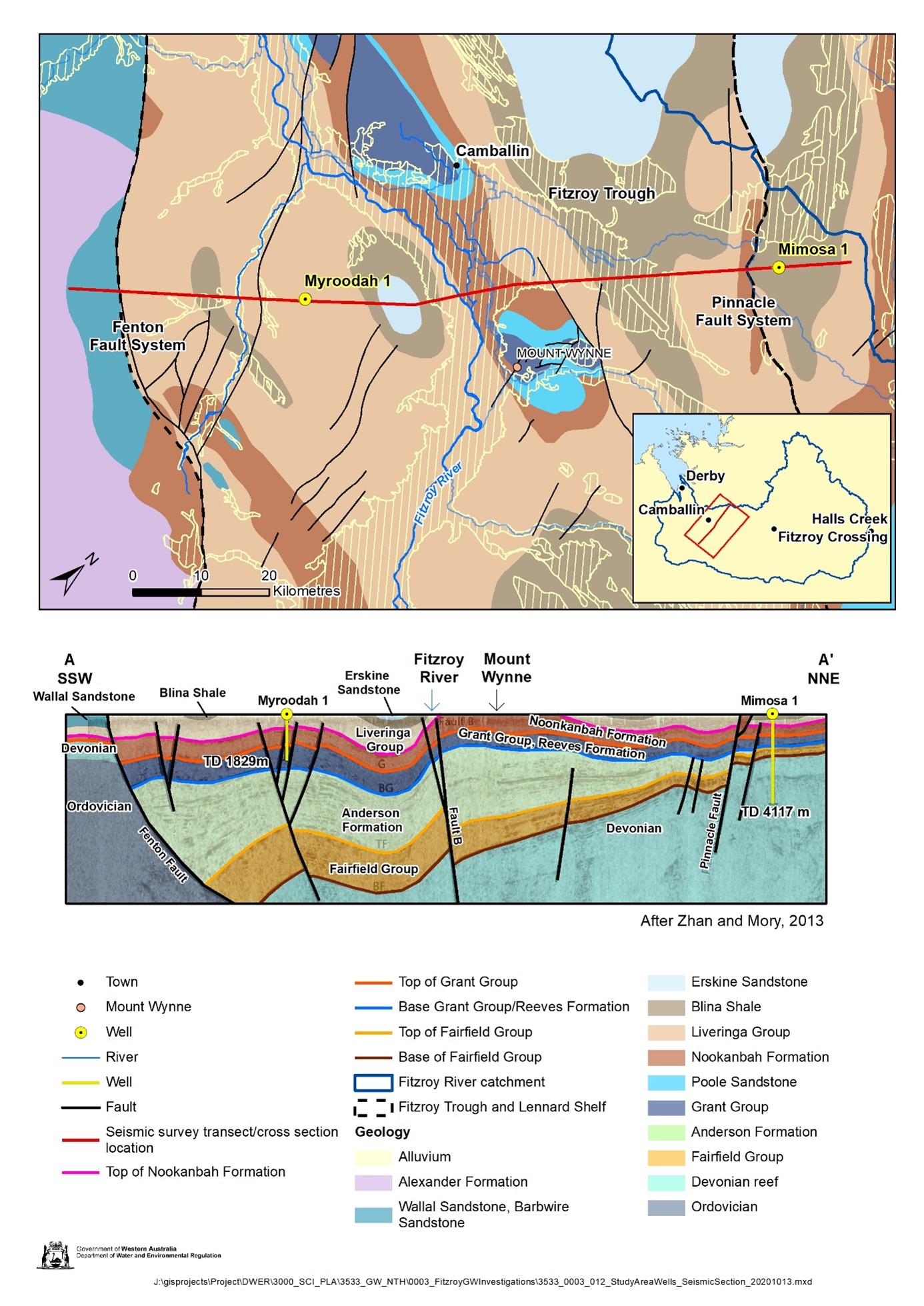
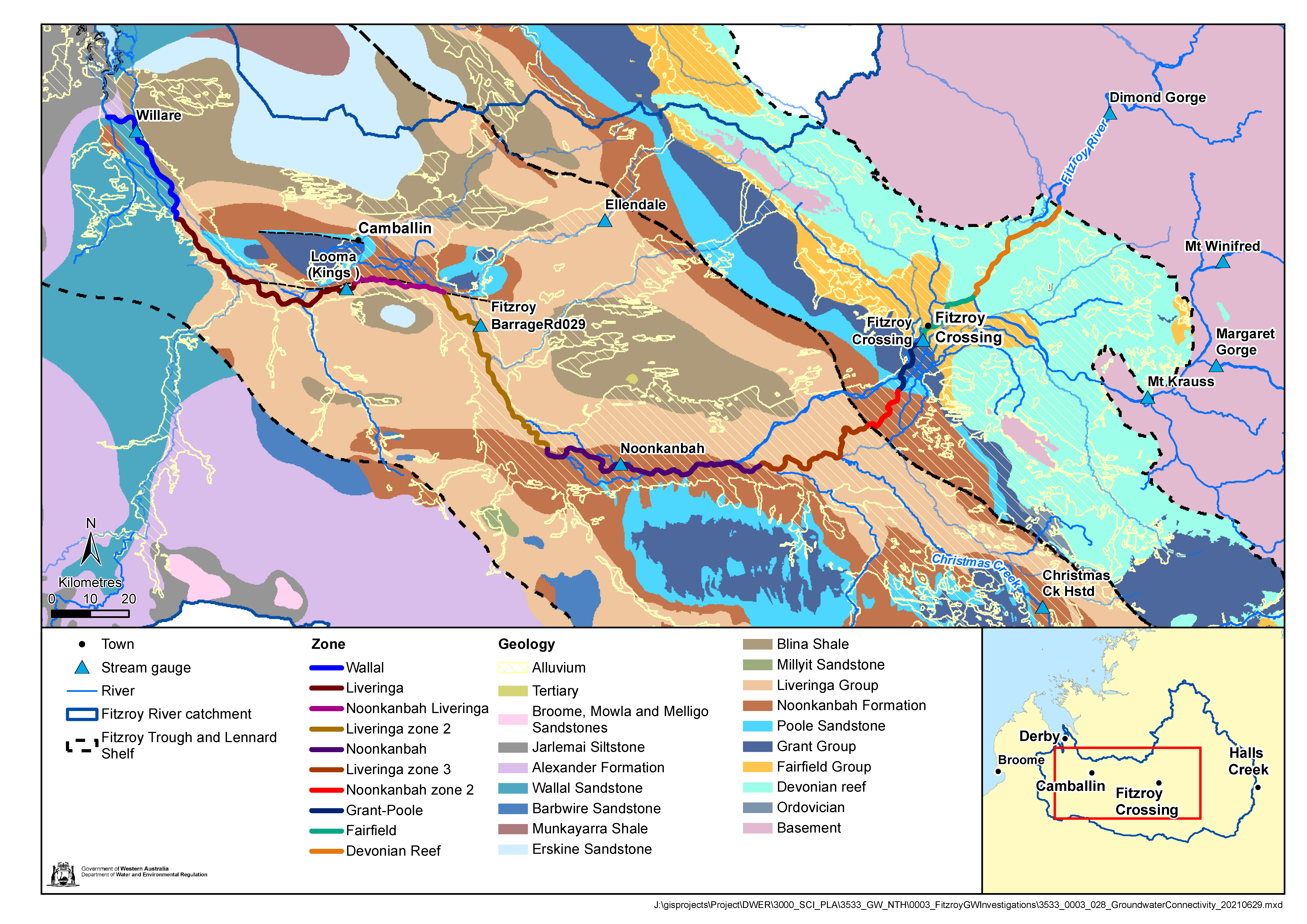
Download the report and maps below.
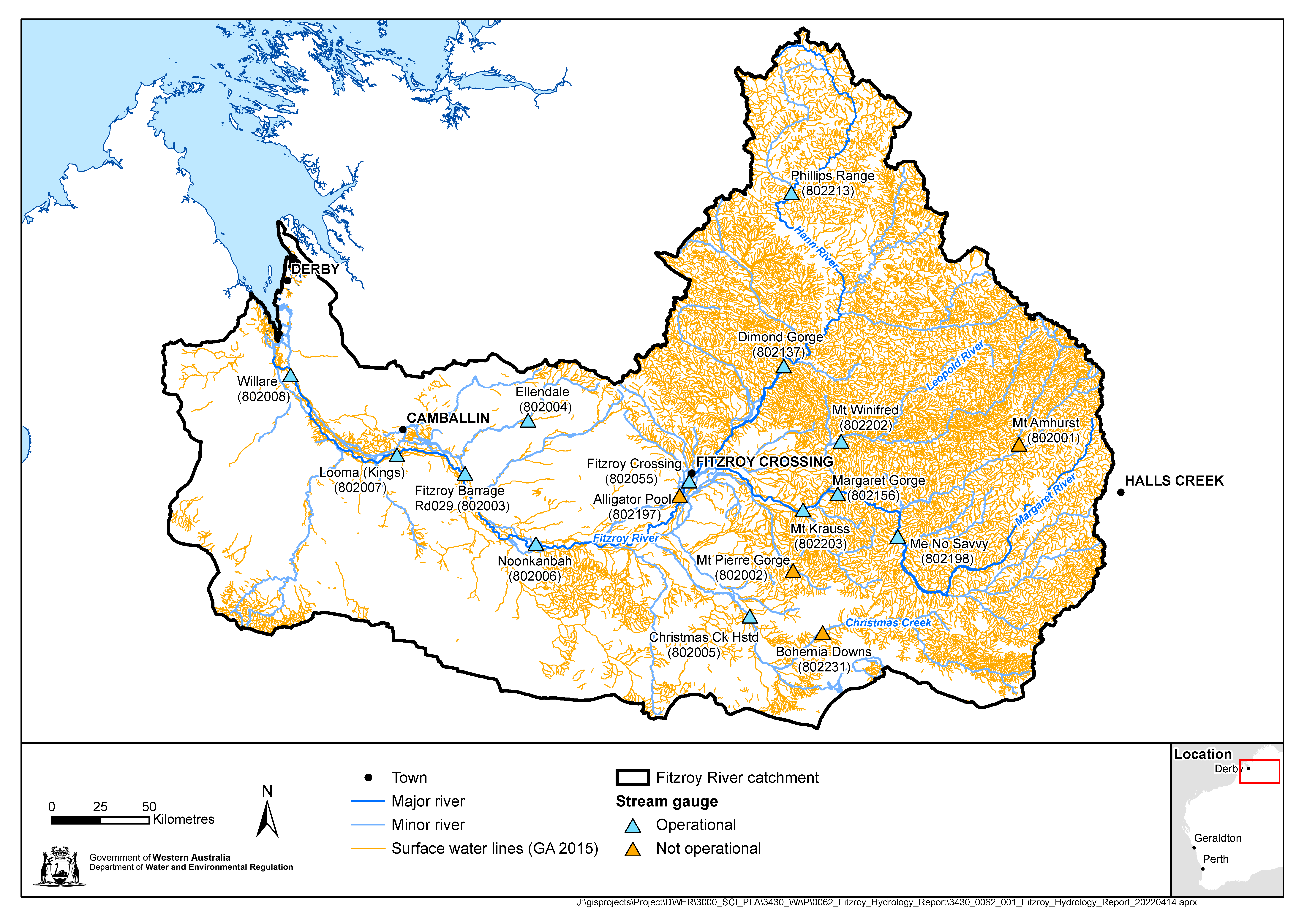
Hydrology of the Fitzroy River: Information to support water management in the Fitzroy River
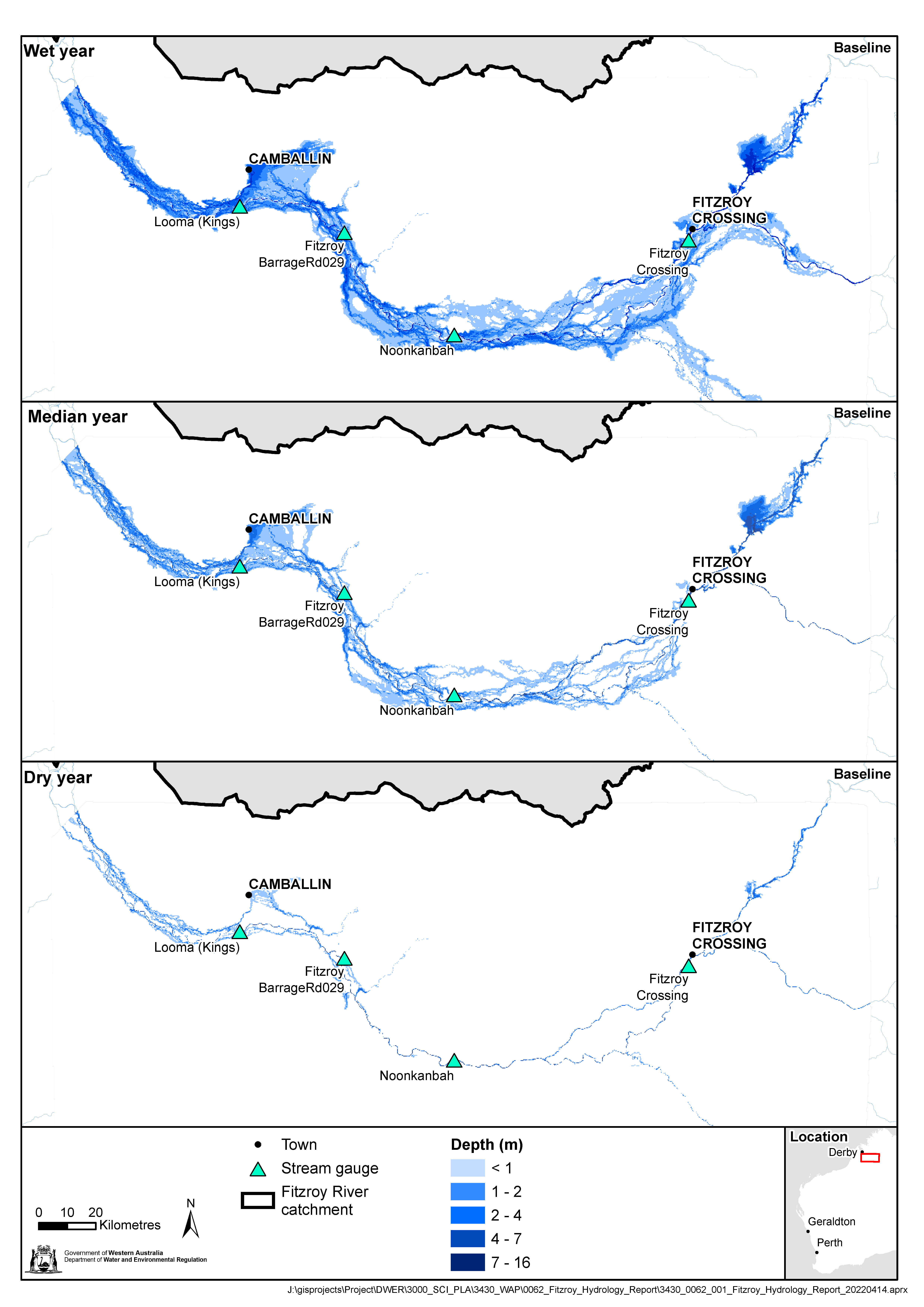
Our Hydrology of the Fitzroy River: Information to support water management in the Fitzroy River describes the hydrology of the Fitzroy River and tributaries using climate data, streamflow monitoring and modelling. Information on the volume, variability, and seasonality of flow in the Fitzroy River and tributaries is presented.
The report shows how surface water varies both across the year and across the catchment – information which will be necessary for future review of the surface water allocation limit. The report also provides information on flooding in the Fitzroy River and inundation of the floodplain, including the January 2023 flood event. It also considers the influence of climate change on flow in the Fitzroy River and the future implications for managing water in this region.
The report describes the large differences in the amount of water flowing in the Fitzroy River between wet and dry years. This variation is dependent on the occurrence of cyclonic weather events and monsoonal activity. The river is generally flowing for a short period of the year, typically between November and April. As rainfall decreases from about April, water levels recede and the river dries to form a series of disconnected pools. The hydrology of the river influences both the natural environment as well as the shape of the river, which varies from well-defined incised channels (generally in the north-eastern parts of the catchment) to floodplains with braided streams (along the western areas of the Fitzroy River catchment).
Download the report and maps below.