Plan release information
The Lower Gascoyne water allocation plan was released in October 2011.
Supporting documents for the plan are also available:
- Lower Gascoyne allocation plan: Methods report
- Lower Gascoyne allocation plan: Statement of response
The methods report describes how the department decided on allocation limits in accordance with our planning process.
The statement of response summarises our response to public comments and submissions received on the Lower Gascoyne groundwater and surface water allocation plan: draft for public comment released in November 2010.
Parts of the plan were updated in March 2015 as an outcome of our 2013–2014 evaluation of the plan. We made improvements to when a low aquifer storage event is triggered and a number of local licensing policies. These changes are essential to adapting our water management in the plan area.
The improvements to the low aquifer storage trigger provide better certainty for growers on how much freshwater is available for use when an event is announced.
The changes to the licensing policies will help licensees in Subarea A gain better access to both freshwater and water with higher salinity, under certain circumstances. This will give growers more opportunities to maximise the productive use of the resource.
Water allocation planning in the Lower Gascoyne
The Gascoyne River ground and surface water resources are vital to the Carnarvon community, in particular for town supply and the irrigated horticultural industry.
Water allocation planning in the Lower Gascoyne is needed to:
- maximise the volume of water for abstraction, while minimising the risk to groundwater quality, individual licensee supply reliability, and to in situ values
- ensure continued provision of good quality water from Subarea B‑L for the town of Carnarvon’s drinking water needs
- support the increasing agricultural potential of the region by allocating additional water in Subarea B‑L, through water service providers
- redistribute water abstraction from areas of poor water quality to areas of high water quality to avoid permanent salinity damage and maximise the productive use of the resource.
Plan area
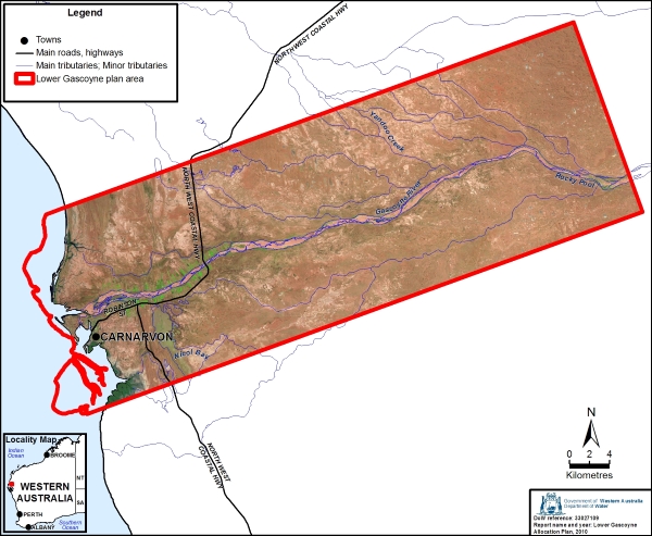
The Lower Gascoyne plan area is about 900 kilometres north of Perth. It covers the Town of Carnarvon and the lower reaches of the Gascoyne River from the coast to Rocky Pool.
The Lower Gascoyne plan area is divided into groundwater subareas for licensing and allocating water – Subarea A, Subarea B–L, and the Surficial aquifer which is called Yandoo.
Water resources
Groundwater from the Lower Gascoyne alluvial aquifer is the main water source in this area. The Lower Gascoyne alluvial aquifer is made up of the Riverbed Sands and Older Alluvial formations. We manage them together as a single resource when allocating water.
Groundwater salinity is the critical issue for groundwater management in the plan area. Licensees and the Carnarvon community are actively involved in managing the take of water in the Lower Gascoyne to minimise the impacts of salinity on the resource.
Surface water in the Lower Gascoyne plan area is only available during, or immediately after, the Gascoyne River flows. When the river is flowing licensees can apply to access this unrestricted water to maximise the use of water when it is abundant.
Publications
Lower Gascoyne water allocation plan
Lower Gascoyne allocation plan: Methods report
Lower Gascoyne water allocation plan: Statement of response
Lower Gascoyne groundwater and surface water allocation plan: draft for public comment
The development of the Gascoyne Aquifer System using GASFAMS v1.1 (Vol. 1)
The assessment of the Gascoyne Aquifer System using GASFAMS v1.1 (Vol. 2)
Peer review of the Gascoyne River Floodplain Aquifers Modelling System