Plan release information
- The Middle Canning River surface water allocation plan and Statement of response were released in September 2012. The plan describes how we will allocate and manage water resources in the middle Canning River (between the base of the Canning Dam and Kent Street Weir) and how we will monitor, measure and evaluate the objectives of the plan.
- The Middle Canning River surface water allocation plan: 2024 evaluation statement was released in June 2025. The statement reviews the performance of the allocation plan and formalises changes to allocation limits and river release arrangements that had occurred since the release of the allocation plan in 2012.
Water allocation planning in the Middle Canning River
The 2012 Middle Canning River surface water allocation plan was the first allocation plan completed for the surface water resources of the middle Canning River. The plan responded to the decline in winter rainfall and lower river flows, reduced demand by property owners along the river to pump surface water due to changing land use and increasing demand for scheme water outside of the plan area.
The plan lowered the allocation limit, improved the efficiency of summer river releases from the Canning Dam through updated release rules and included a management focus on reducing surface water use from the river by gradual recouping of unused water entitlements as land use changed.
The Middle Canning River surface water allocation plan: 2024 evaluation statement confirms the same trends of warmer and drier conditions and declining flows are still occurring in the middle Canning area since the release of the 2012 plan. The statement formalises further reductions to the allocation limit that have been made since 2012 and reaffirms the ongoing policy of recouping unused entitlements. Changes to river release arrangements that had occurred since the release of the plan are also detailed in the evaluation statement.
The evaluation statement highlights the need for a review of the river release arrangements for the middle Canning River to respond to future climate change risks.
Plan area
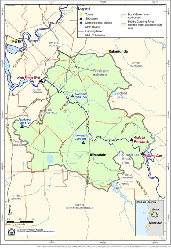
The Middle Canning River surface water allocation plan area covers the part of the Canning River that runs through the cities of Armadale, Gosnells, Kalamunda and Canning, between the base of the Canning Dam and the Kent Street Weir.
Water resources
The flows in the upper part of the Canning River have been stored in Canning Dam since 1940 to provide water for Perth and the Integrated Water Supply Scheme.
Treated scheme water is released into the middle Canning River over summer. Originally provided to supply downstream residents with water for domestic and economic purposes, nowadays a primary purpose of these releases is to support the river's ecological, social and cultural values during periods of low flow.
Publications
Middle Canning River surface water allocation plan: 2024 evaluation statement
Middle Canning River surface water allocation plan
Middle Canning River surface water allocation plan: Statement of response
Lower Canning River surface water allocation plan: for public comment
Ecological water requirements for the lower Canning River
Ecological study of the lower Canning River environmental water releases
Environmental values, flow related issues and objectives for the Canning River