Plan release information
The Rockingham–Stakehill groundwater management plan was released in 2008.
The plan includes allocation limits, which define how much water is available in the Rockingham–Cockburn area. It describes how the department will allocate and manage water resources and how it will monitor, measure and evaluate the objectives of the plan.
The Rockingham-Stakehill groundwater management plan: Evaluation statement 2008–2011 reported on the first three years of implementation.
Water allocation planning in the Rockingham-Stakehill area
Planning is essential to ensure the needs of the community and the environment are protected and water supplies are secure for future generations.
Plan area
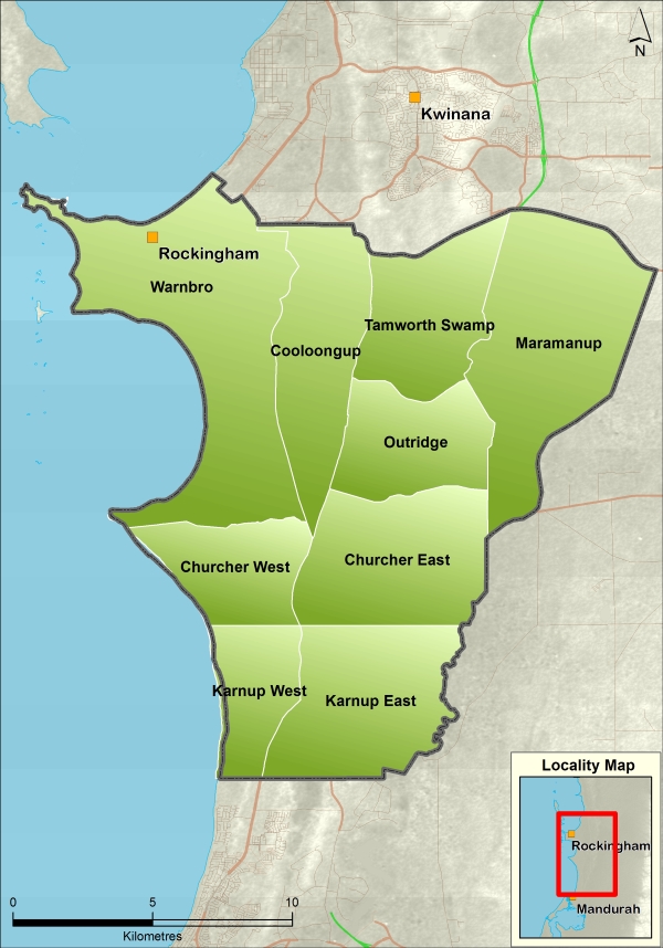
The Rockingham–Stakehill plan area covers 218 km2 of the Swan Coastal Plain and is located 30 kilometres south of Perth in the City of Rockingham. It includes the Serpentine River and the Peel main drain to the east.
The plan covers the Rockingham and Stakehill groundwater areas. Adjacent groundwater areas are Cockburn to the north, Serpentine to the east, and South West Coastal and Murray to the south.
Water resources
The groundwater resources in the plan area, in order of increasing depth are the unconfined Superficial and Rockingham Sand, Leederville (semi-confined) and Yarragadee (confined) aquifers. The Yarragadee aquifer includes the Yarragadee Formation in the north-east of the Baldivis subarea, and the Gage Sandstone and Cattamarra Coal Measures elsewhere in the Rockingham-Stakehill groundwater area.
Groundwater abstraction for private use in the Rockingham-Stakehill area draws from both the Superficial and Rockingham Sand unconfined aquifers and the semi-confined Leederville aquifer, with the majority of groundwater abstraction from the Superficial Aquifer.
For management purposes, the Rockingham–Stakehill area is divided into nine subareas – Warnbro, Cooloongup, Tamworth Swamp, Maramanup, Outridge, Churcher East, Churcher West, Karnup East and Karnup West.