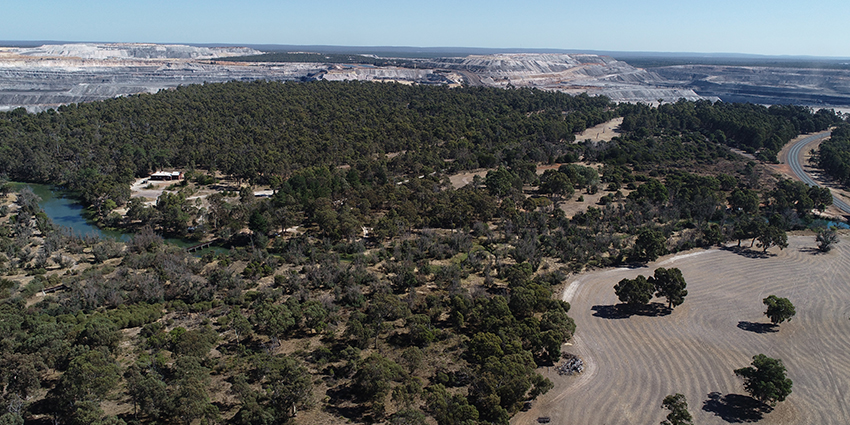
The Collie Basin lies about 160 km south-southeast of Perth, in Western Australia’s South West region. The basin contains substantial resources of fresh groundwater that have been historically important for the region. A good understanding of the hydrogeology and groundwater resources of the basin is important for sound management of the groundwater resources and the associated environment.
The Collie groundwater investigation is a multifaceted project to improve our understanding of groundwater processes and to inform whole-of-government decision making in the Collie Basin. The project was initiated following growing interest in groundwater availability in Collie. We now need to extend the monitoring network and obtain additional data to improve our understanding of the interaction between groundwater and surface water, and where there may be changes to water quality.
Information collected in this investigation will assist the Department of Water and Environmental Regulation’s assessment of water resource availability in the Collie Basin.
The investigation may also benefit the implementation of the State’s Collie Just Transition and coal mine closure planning, currently being led by the Department of Energy and Economic Diversification (formerly the Department of Jobs, Tourism, Science and Innovation).
Areas for investigation
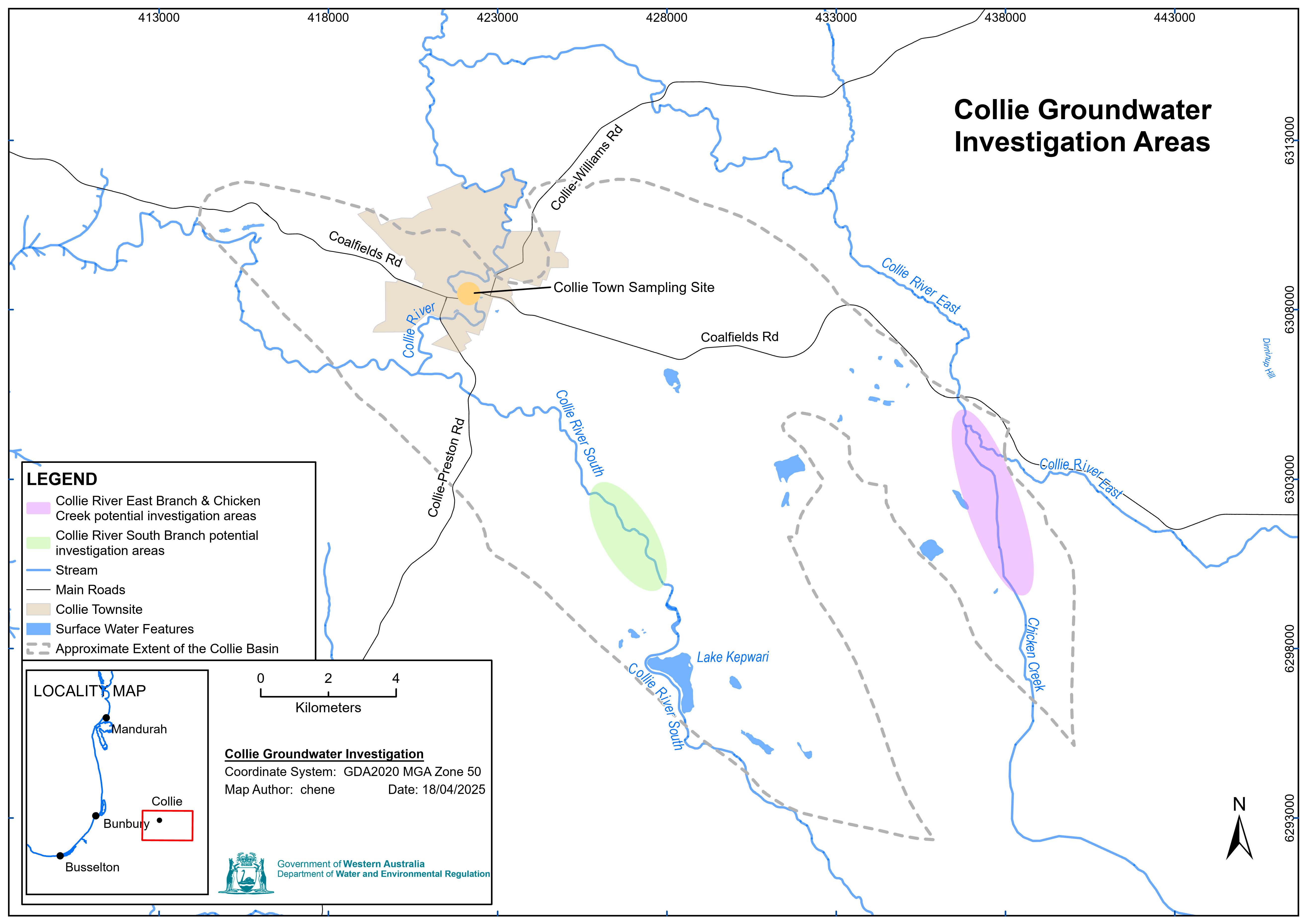
The areas of interest for the Collie groundwater investigation include the Collie River South Branch (CRSB), Collie River East Branch (CREB) and Chicken Creek (CC) where transects of monitoring bores are planned for installation. Additionally, surface water and sediment sampling will likely be conducted at a groundwater expression location within the Collie townsite. This will build on existing knowledge in the area, including that gained from:
- HG5 – Hydrogeology and groundwater resources of Collie Basin
- Triennial aquifer reporting from Industry operators
- Ongoing department surface water and groundwater monitoring data
What's next?
We have completed an airborne electromagnetic (AEM) survey (approximately 816 line kilometres of data) to support our groundwater mapping using the geophysical data obtained in the survey. From March 2026, we will be installing additional groundwater monitoring bores along the Collie River South Branch, Collie River East Branch and Chicken Creek, which will further inform groundwater mapping. We expect that drilling will take approximately three months. This will be followed by 12 months of monitoring and the preparation of a technical report.
The Collie groundwater investigation drilling and monitoring program fact sheet provides further information on our current activities in the area.
Access to data from the monitoring bores installed as part of this investigation will be made available via our Water Information Reporting portal.
More information
For more on the Collie groundwater investigation, email groundwater.info@dwer.wa.gov.au
For more information on how we manage groundwater and surface water in the Collie area see the Upper Collie Water Allocation Plan.
Read more about our groundwater investigations by region across Western Australia.