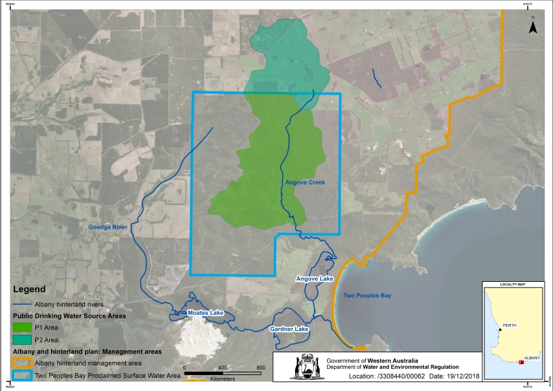
Two People’s Bay surface water area is located about 30 kilometres east of Albany, with water from Angove Creek used to supplement the public drinking water supplies for Albany and towns of the Lower Great Southern Region.
This area was proclaimed in 1997 under the Rights in Water and Irrigation Act 1914 to regulate how water is taken from Angove Creek, protect important environmental values and the long-term availability of the supply.
Water quality is protected by managing the land uses in the Angove Creek catchment drinking water source protection area, proclaimed in 2012 under the Country Areas Water Supply Act 1947.
The upper reaches of Angove Creek lie inside the Two People’s Bay surface water area, then flow into Angove Lake. The Angove system supports important water dependent environments in the area, including an isolated and landlocked population of the critically endangered Western Trout Minnow (Galaxius truttaceus hesperius)
The lower reaches of Angove Creek and a portion of Angove Lake are zoned Special Conservation, within a portion of the Two People’s Bay Nature Reserve.
The minnow and its environment are protected by the Fish Resources Management Act 1994 and the Environment Protection and Biodiversity Conservation Act 1999. The 2008 Western Trout Minnow Recovery Plan was adopted as a National Recovery Plan under the Environment Protection and Biodiversity Conservation Act 1999.
Water resources
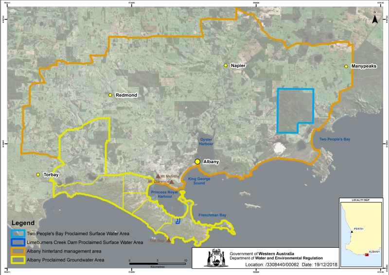
The water resources of the area are across the proclaimed Albany groundwater area, the proclaimed Two People’s Bay surface water area and the unproclaimed groundwater resources of the surrounding Albany hinterland.
The area is divided into groundwater subareas, surface water areas and prospective groundwater zones to manage the resources and how water is licenced. The Albany groundwater area is divided into six subareas:
- Frenchman’s Bay
- Sandpatch
- Prison
- Racecourse
- Grasmere
- Marbellup.
The Two People’s Bay surface water area is where water is pumped from Angove Creek.
The Albany hinterland groundwater resource areas are the King River, Kalgan River, Manypeaks and Nanarup zones..
Groundwater use in this area is mainly for:
- public water supply for Lower Great Southern towns and the City of Albany
- irrigation of public open space and sporting grounds
- irrigated commercial horticulture
- stock watering and domestic gardens.
All these above uses are licensed, except stock watering and domestic garden use.
Angove Creek supplements groundwater use for public water supply, currently making up about 10 per cent of the total supply to towns of the Lower Great Southern Region. Pumping water from Angove Creek dam is regulated through a water licence.
Limeburner’s Creek was licensed for public drinking water supply up to 1999. It is no longer used as a source of public drinking water.
Groundwater resources identified in the Albany hinterland area have the potential to meet the future demand for drinking water supplies, and fit-for-purpose industry and agricultural uses.
Publications
Marbellup Brook Catchment Area drinking water source protection plan
Angove Creek catchment area drinking water source protection plan
Great Southern regional water supply strategy
Albany hinterland prospective groundwater resources map
Albany hinterland prospective groundwater resources map: Explanatory notes
Mapping water availability in the palaeochannels of the Albany Hinterland
South Coast Water Reserve and Limeburners Creek catchment area water source protection plan