Plan release information
The Whicher area surface water allocation plan and Statement of response were released in September 2009.
We have since evaluated our management against the plan's objectives:
- Whicher area surface water allocation plan: Evaluation statement 2013–2016
- Whicher area surface water allocation plan: Evaluation statement 2009–2012
The water allocation plan continues to be appropriate for managing water resources. We monitor surface water in the Whicher region, which provides data on streamflow, and water quality. We also regularly assess river health in the Whicher region. These assessments look at how aquatic life is affected by climate change, such as higher temperatures and less rainfall. In 2024, we found that the Margaret River's ecosystems are resilient, with all expected species in good condition.
Water allocation planning in the Whicher area
Planning is required to ensure that the needs of the community and the environment are protected while making sure there are secure water supplies in the future.
Some of the key concerns for water planning in the Whicher area include increasing demands from agriculture and viticulture industries, increasing water scarcity and the need to provide a reliable supply to users. Securing supply through licences is an important part of making sure every user has their needs met without unduly impacting on others.
Plan area
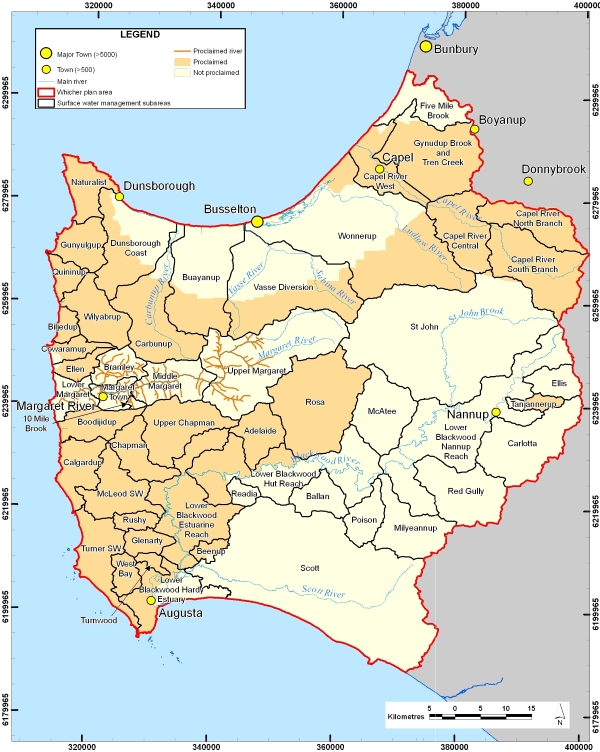
The Whicher area, in the south-west of Western Australia, extends from Cape Naturaliste to Cape Leeuwin and east of Nannup.
The plan area covers the Capel River, Geographe Bay Rivers, Cape to Cape North, Cape to Cape South, Lower Blackwood River and Tanjannerup Creek surface water areas and Margaret River and tributaries.
Water resources
The surface water resources of the Whicher area include the Margaret, Capel and lower Blackwood Rivers and their tributaries, as well as a large number of smaller streams that flow to the coast. The Whicher area covers the Busselton Coast, Capel River and lower Blackwood surface water management areas.
For management purposes, the plan area is divided into 52 surface water management subareas (identified on the map), based on the catchments of the rivers and their smaller tributaries.
Publications
Whicher area surface water allocation plan
Whicher area surface water allocation plan: Statement of response
Whicher surface water allocation limits: Methodology
Whicher area surface water allocation plan: Evaluation statement 2013–2016
Whicher area surface water allocation plan: Evaluation statement 2009–2012
Methods used to estimate total surface water use and agricultural demand in the Whicher area
Ecological water requirements of the Margaret River