Project findings provide a detailed conceptual hydrogeological framework for the southern Dandaragan Plateau. In addition, newly installed monitoring infrastructure will continue to provide information that supports the assessment and management of agricultural and town water supply, while balancing groundwater requirements for ecological, social and cultural values.
In the southern Dandaragan Plateau, groundwater level declines have been observed across the Mirrabooka and Leederville-Parmelia aquifers and streamflow in perennial brooks such as Gingin Brook. Water demand for irrigated agriculture, mining and public water supply is consistently high.
What the investigation involved:
- An airborne electromagnetic (AEM) survey covering 8,200 square kilometres.
- 5,438 metres of drilling comprising 26 groundwater monitoring bores at 14 sites to a maximum depth of 420 metres.
- Development of a 3-D GOCAD model of the major aquifers, aquitards and the structural fault across the southern Dandaragan Plateau.
- Installation of groundwater-level dataloggers in the newly constructed monitoring bores to collect ongoing time-series water-level data.
- Groundwater chemistry, stable isotope and groundwater age dating analyses from the newly installed bores, selected existing bores and surface water/groundwater interaction investigation sites.
Key technical findings:
Key findings and outputs from the investigation include:
- Refined geometry of the Mirrabooka and Leederville-Parmelia aquifers and the Kardinya aquitard under the Dandaragan Plateau.
- Mapping the Charlotte Sandstone of the Parmelia Group onshore for the first time. Interpretation of a new formation of late Aptian age named the “Moondah Formation”. Refinement of the geometry of the Muchea Fault.
- Groundwater in all aquifers on the Dandaragan Plateau flows in an easterly to westerly direction towards the coast. Southerly directed groundwater flow emanating from the Dinner Hill groundwater subarea to the north was found to rotate to the predominant east-west flow direction in the vicinity Minyulo and Caren Caren Brooks.
- Areas of hydraulic connection were identified between the Mirrabooka and Leederville–Parmelia aquifers on the Dandaragan Plateau, and between the Superficial and Leederville aquifers on the Swan Coastal Plain. These connections were observed where the overlying sediments above the subcropping Carnac–Otorowiri aquitard are thickest.
- 3-D salinity mapping highlighted that there is very fresh groundwater (<500 mg/L total dissolved solids) of up to 300 m thickness in the southern-most part of the investigation area, within Mirrabooka aquifer and upper parts of the Leederville-Parmelia aquifer. North of the Moore River, pockets of very fresh groundwater up to around 80 m thick were found mainly in the Mirrabooka aquifer.
- Water table fluctuation recharge estimates indicated recharge rates under cleared conditions was two to four times greater than under pre-clearing native vegetation conditions. This is evidenced by groundwater levels and summer stream flows north of Red Gully Creek and Moore River, which are still rising significantly in response to historical land clearing that took place during ~1960s-1980s.
- The perennial brooks across southern Dandaragan Plateau were found to be supported by groundwater discharge from the Mirrabooka and Leederville-Parmelia aquifers. Discharge from the perennial brooks onto the Swan Coastal Plain was found to provide an important source of concentrated recharge for the Superficial aquifer, especially in the Chandala Plain area at the top of the Gnangara groundwater system.
The data and conceptual findings from this project are currently being used to inform a new Gingin water allocation plan to replace the 2011 Gingin surface water allocation plan and 2015 Gingin groundwater allocation plan. This includes providing the conceptual framework for a 3-D numerical groundwater model covering the southern half of the Gingin groundwater area. For further information on water allocation planning in Gingin see the Gingin groundwater and surface water Gingin groundwater and surface water allocation plans: 2024 evaluation statement.
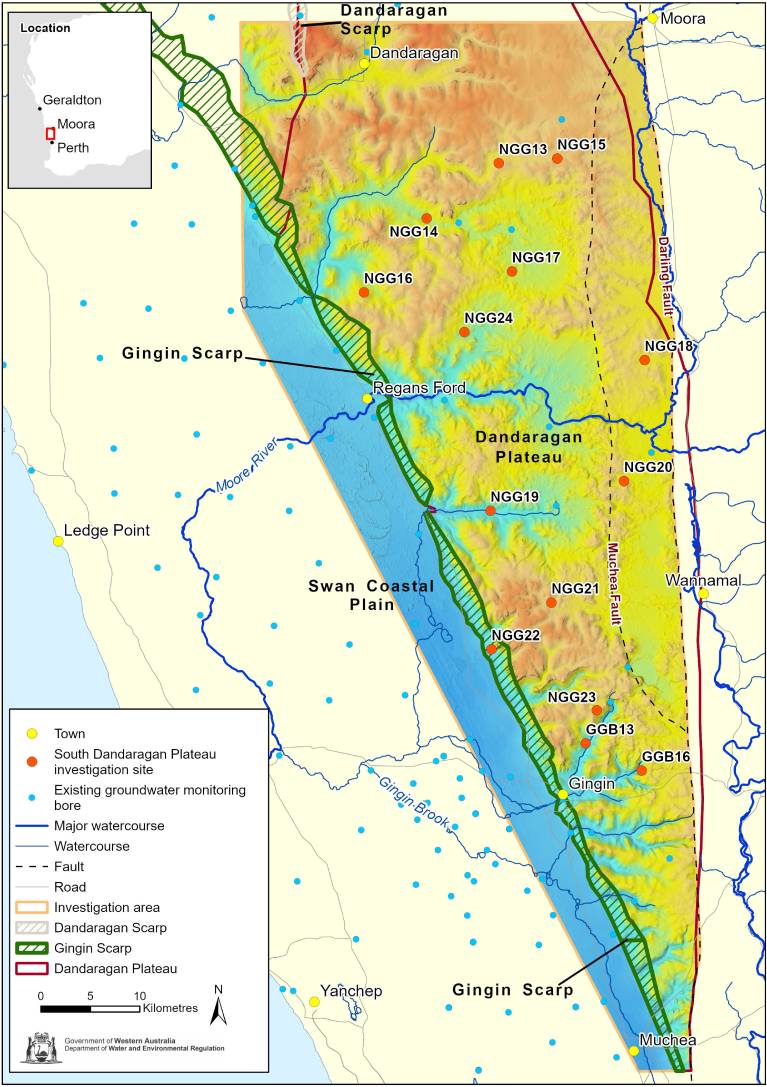
East Midlands groundwater investigation project area
Where to get more details:
You can request a copy of the Groundwater Investigation Report: HR431 or the Bore Completion Report: HR413 for the East Midlands project by emailing groundwater.info@dwer.wa.gov.au.
Go to our Water Information Reporting portal to access data from the monitoring bores installed during the investigation.
You can access all government-commissioned airborne geophysical surveys via the Department of Mines, Industry Regulation and Safety website and download them from ‘Geophysical Surveys’ in GeoVIEW.WA or from the Geophysical Archive Data Delivery System (GADDS).
Read more about our groundwater investigations by region across Western Australia.