Plan release information
The Waangaamaap – Serpentine groundwater allocation statement is part of the State Government’s Waterwise Program to establish leading waterwise communities for Boorloo (Perth) and Bindjareb (Peel) by 2030.
Water allocation planning in the Serpentine area
The 2024 Waangaamaap – Serpentine groundwater allocation statement describes our review of allocation limits in the Serpentine groundwater area and Keysbrook subarea of the Stakehill groundwater area in the context of past and projected changes in rainfall due to climate change.
Previous allocation limits for these areas did not consider reductions in rainfall and recharge due to climate change.
Information considered in the review included technical studies completed as part of the Peel Integrated Water Initiative (PIWI), which found that climate change had already affected the availability of surface and groundwater resources in the area. The PIWI work concluded it was crucial that any subsequent review of allocation limits or the water needs of groundwater-dependent ecosystems included consideration of the future effects of climate change.
What are the key outcomes of the Waangaamaap – Serpentine groundwater allocation statement?
- Due to reducing rainfall as a result of climate change, the allocation limits that were set in 1995 for the Serpentine groundwater area and 2008 for the Keysbrook subarea of the Stakehill groundwater area, are no longer sustainable.
- New allocation limits have been set that will improve the security of supply of existing groundwater users over the coming decade, and reduce the risk of impacts to groundwater-dependent ecosystems and cultural values from over-abstraction of groundwater.
- The groundwater entitlements of existing licensees are not affected by the new allocation limits.
- Many groundwater resources in the area are now fully allocated and access to more groundwater is limited.
- The updated allocation limits signal the need to meet future water demand through greater water use efficiency, water trading, and in some cases alternative water sources.
- We will continue to collaborate with the State and local governments and industry groups to enable regional development and growth through fit‑for‑purpose water servicing.
The Waangaamaap – Serpentine groundwater allocation statement is part of the State Government’s Kep Katitjin – Gabi Kaadadjan – Waterwise Perth Action Plan 2 to establish leading waterwise communities for Boorloo (Perth) and Bindjareb (Peel) by 2030.
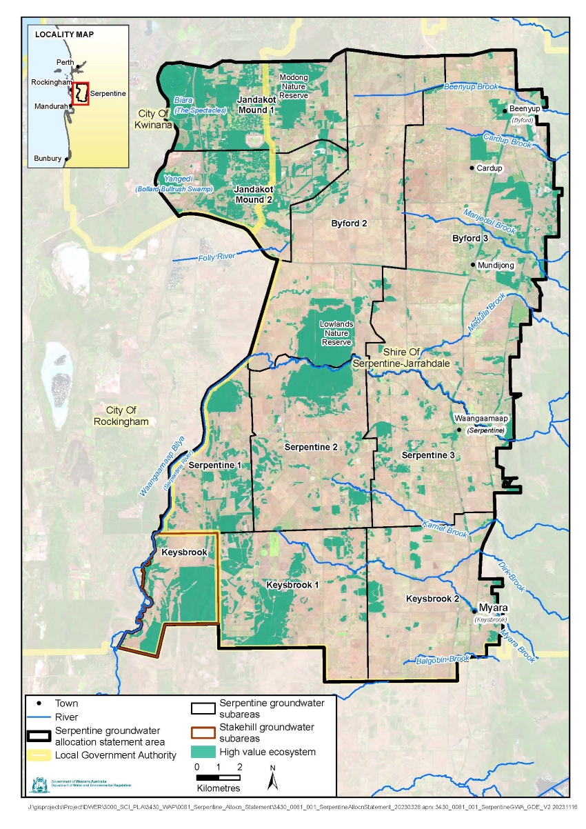
Statement area
The Waangaamaap – Serpentine groundwater statement area is located approximately 30 km south of Boorloo (Perth) and covers 430 km2.
The majority of licensed groundwater use in the area is for agricultural purposes including irrigation of pasture, vegetables, intensive stock raising and nurseries. The other main use of groundwater is for the establishment and ongoing irrigation of parks, ovals and other public open space areas by developers and local governments. Groundwater is also used for small-scale stock and domestic and garden bore uses that may be exempt from licensing.
Groundwater in the area provides base flow for streams and rivers, including the Waangaamaap Bilya (Serpentine River). Groundwater also sustains valuable natural areas, which include wetlands and bushland that lie over shallow groundwater such as Banksia woodlands. These groundwater-dependent ecosystems are important to the communities in the region and to the continuing culture of the Bindjareb Noongar people.
Water resources
Aquifers in the statement area are made up of layers of water-holding sands and gravels interspersed with clays. The following aquifers provide for most of the groundwater for consumptive uses in the statement area:
- the shallow, unconfined Superficial (watertable) aquifer
- the deep, partially confined Leederville aquifer
- the deeper, partially confined Cattamarra Coal Measures (a layer of the Yarragadee aquifer).
Small volumes of water are also taken from fractured rock aquifers along the statement area’s eastern margin.
The Superficial, Leederville and Yarragadee aquifers are present in all subareas of the Serpentine groundwater area. The Cattamarra Coal Measures resource and fractured rock aquifers only exist in the three easternmost subareas.
The Keysbrook and Stakehill–Keysbrook Confined subareas in the Stakehill groundwater area include the shallow Superficial and Rockingham Sand aquifers, and the deep Leederville aquifer and Cattamarra Coal Measures resource.
To enable more effective management of abstraction impacts, the statement area is divided into subareas.